Wetland Buffer and Riparian Setback Rules for Apalachicola River Second Homes
September 29, 2026 by Melissa Chandler
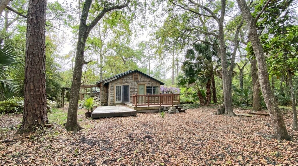
What are the wetland buffer and riparian setback restrictions for second homes along the Apalachicola River in 2026, and how do they limit what you can build or renovate?
Along the Apalachicola River, you must observe a minimum 50-foot setback from mean high water or wetlands under Franklin County code, a 25-foot upland buffer at the state level, and a 150-foot critical shoreline inspection zone, all of which significantly reduce your buildable area.
Why This Matters Right Now in Apalachicola
If you’re drawn to Apalachicola for its unmatched biodiversity, its quiet streets shaded by live oaks, and the fact that this town of 2,231 people still smells like salt water and old pine, you already understand why the environment here needs protecting. But that same ecological richness is exactly what creates layers of regulation you need to understand before you write a check.
The Apalachicola Bay Area is explicitly designated as an area of critical state concern by the Florida Department of Environmental Protection. The Apalachicola River itself is one of the most biodiverse river systems in North America. And the Florida Forever Plan 2025 lists the Apalachicola River as a priority conservation acquisition area. What all of that means for you, practically, is that your dream second home along this river corridor faces more regulatory scrutiny than almost anywhere else in Florida.
I’ve spent 13 years and over 300 transactions helping buyers navigate Florida Gulf Coast real estate. Let me walk you through what you’re actually up against.
The Four Regulatory Layers You Face When Building Near the Apalachicola River
Here’s the part that catches most second-home buyers off guard: there isn’t just one agency telling you what you can and can’t do. There are four, and their rules stack on top of each other.
- Federal (U.S. Army Corps of Engineers and EPA): The Clean Water Act requires a federal permit for any dredge or fill activity in waters of the United States, including wetlands. If your lot touches wetlands, and along the Apalachicola River many do, you may need federal sign-off before you move a shovel of dirt.
- State (Florida DEP): Since December 2020, FDEP has administered what was previously the federal Section 404 permitting program. The state imposes a minimum 25-foot upland buffer from wetlands, per Environmental Resource Permit requirements. Local requirements along this coast often run 50 to 100 feet or more.
- Water Management District (NWFWMD): The Northwest Florida Water Management District administers Environmental Resource Permits for your region and has its own authority to regulate dredge and fill operations in both connected and isolated wetlands.
- Franklin County: This is where the most specific, day-to-day restrictions hit your site plan. And this is where most buyers need to pay the closest attention.
So how does all of this translate to what you can actually put on your lot? Let me break it down.
Franklin County’s 50-Foot Setback and What It Does to Your Apalachicola Building Envelope
Franklin County’s code is clear: construction on lots located on the water must be at least 50 feet from the mean high water line. For subdivision plats, that same 50-foot minimum applies from any wetlands and/or mean high water line, according to county land development regulations.
Here’s the catch that makes this especially tricky along the Apalachicola River. Wetlands frequently extend well inland from the visible river’s edge. Your lot might look like a generous half-acre, but once a certified wetland delineation is completed, you could discover that wetlands cover a significant portion of the parcel, pushing your buildable envelope into a much smaller footprint than you expected.
Franklin County staff themselves state plainly that they cannot confirm whether a lot is buildable. The only way to confirm buildability is to obtain a survey that includes all setback lines and any wetland coverage. What I tell my clients is this: get the survey done before you fall in love with the property, not after. That survey is your reality check.
The 150-Foot Critical Shoreline Inspection Zone
Beyond the 50-foot setback, any construction within 150 feet of the mean high water or wetlands triggers a mandatory Critical Shoreline Inspection by the Building Official before the county will issue a building permit. This adds time, cost, and another opportunity for your project to be flagged.
The Variance Requirement Inside 50 Feet
If you want to build anything within 50 feet of mean high water or wetlands (with the exception of private docks), you need a variance from the Board of Adjustment and approval from the Planning and Zoning Commission, per Franklin County regulations. Variances are not rubber stamps. You must demonstrate genuine hardship, and approval is never guaranteed.
How Wetland Buffers in Apalachicola Limit Renovations and Substantial Improvements
Buying an existing cottage and planning to renovate? You’re not off the hook. In fact, renovation projects along the Apalachicola River can run into their own set of complications.
If your renovation constitutes a “substantial improvement,” meaning the cost exceeds 50 percent of the structure’s market value, you trigger full compliance with current flood codes. That may mean elevating the entire structure, which is an expensive and complicated proposition for a 1920s-era Apalachicola cottage built of heart pine and cypress.
You also need to account for wind load requirements. All structures in Franklin County (outside St. George Island, which has its own 140 mph requirement) must meet 130 mph wind speed standards and submit plans with a wind load analysis, per county building code.
The wetland buffer itself, whether the state’s 25-foot minimum or Franklin County’s 50-foot standard, must be maintained in its natural condition. No clearing, no hardscaping, no extending your lawn into the buffer. This buffer is typically maintained by the property owner and may require a conservation easement or deed restriction attached to the deed.
What does this mean in plain terms? You can’t add a screened porch, a pool, or even a shed within that buffer zone without running into regulatory barriers. Accessory structures, including pools, pole barns, and sheds, cannot be constructed until a principal structure is erected, per county code, and they’re subject to the same setback rules.
Dock, Seawall, and Waterfront Structure Restrictions Along the Apalachicola River
For many second-home buyers, the whole point of a riverfront property is water access. So you need to know what’s involved in building a dock or seawall.
Per Florida Administrative Code Section 18-21.004(3)(d), all structures extending into the water, including mooring pilings, breakwaters, jetties, and groins, must be set back a minimum of 25 feet inside your riparian rights lines. Marginal docks have a slightly reduced requirement of 10 feet.
At the county level, no new docks, piers, boat lifts, seawalls, retention walls, or any additions to current ones can be permitted until the site plan has been approved by both the Planning and Zoning Adjustment Board and the Franklin County Commissioners. That is a two-body approval process before you can even apply for the building permit.
If you’re eco-conscious, and if you’re reading this I suspect you are, this process is actually a good thing. It’s what keeps the Apalachicola River corridor from looking like every over-developed waterfront in Florida. But you do need to plan for it.
Wetland Delineation and Survey Requirements Before You Buy in Apalachicola
Before you commit to any riverfront parcel, here’s the step you cannot skip.
Franklin County staff may require a Certified Wetland Delineation as part of a development application when there is potential for wetlands to be present on the property. This is triggered by review of the National Wetlands Inventory, site conditions, or other environmental indicators. You should check the NWI Wetlands Mapper for any parcel you’re considering.
One critical distinction: wetlands and flood zones are not the same thing and do not necessarily correlate, per Franklin County’s own guidance. Wetlands are identified based on hydrology, soil conditions, and vegetation. Flood zones are determined by flood risk and elevation data. A lot can be outside a flood zone and still be heavily wetland-covered, or vice versa.
With 33 five-star reviews and over 300 closed transactions on this coast, what I always tell buyers is that the survey and delineation together are the most important investment you’ll make before closing. They tell you what you’re actually buying, not just what’s on the tax map.
Minimum Building Requirements That Also Apply in Apalachicola
Even after you’ve navigated the wetland and setback requirements, your Apalachicola second home must meet these Franklin County minimums:
- Minimum heated and cooled space: 1,000 square feet for R-1 zoned property, 450 square feet for R-2 zoned property
- Road setback: 25 feet from any road right-of-way
- Side and rear setbacks: 10 feet from side and rear property lines
- Elevation Certificate: Required for substantial improvements in flood zones
Frequently Asked Questions
What is the minimum wetland setback for building a second home near the Apalachicola River?
Franklin County requires a minimum 50-foot setback from mean high water and wetlands for new construction. At the state level, Florida DEP imposes a minimum 25-foot upland buffer through the Environmental Resource Permit program. The county’s 50-foot standard is the controlling restriction for most St. George Island real estate and Apalachicola River properties, per Franklin County land development regulations.
Do I need a wetland delineation before buying a riverfront lot in Apalachicola?
Yes. Franklin County staff cannot confirm that a lot is buildable. The only way to confirm buildability is to obtain a survey that includes all setback lines and any wetland coverage, along with a certified wetland delineation when conditions suggest wetlands may be present, according to Franklin County’s development application requirements.
Can I build within 50 feet of the river or wetlands in Franklin County?
Only with a variance from the Board of Adjustment and approval from the Planning and Zoning Commission. Private docks are the only exception to this variance requirement. You must demonstrate hardship, and approval is discretionary, per county regulations.
What triggers a Critical Shoreline Inspection in Apalachicola?
Any construction within 150 feet of the mean high water or wetlands requires a Critical Shoreline Inspection completed by the Building Official prior to the issuance of a county building permit. This applies to both new construction and significant renovations, per Franklin County code.
Can I clear vegetation in the wetland buffer zone on my Apalachicola property?
No. Wetland buffers must be maintained in natural condition with no clearing. Buffers are maintained by the property owner and may require a conservation easement or deed restriction, per Florida DEP Environmental Resource Permit standards.
What happens if my renovation exceeds 50 percent of the home’s value near the Apalachicola River?
Your renovation is classified as a substantial improvement, which triggers full compliance with current flood codes. This may require an Elevation Certificate and potentially elevating the entire structure, adding significant cost to your project.
How do riparian setbacks affect dock construction along the Apalachicola River?
Per Florida Administrative Code Section 18-21.004(3)(d), all waterfront structures must be set back a minimum of 25 feet inside your riparian rights lines. Marginal docks require a 10-foot setback. Additionally, Franklin County requires site plan approval from both the Planning and Zoning Board and County Commissioners before any dock permits are issued.
Are wetlands and flood zones the same thing in Apalachicola?
No. Franklin County guidance explicitly states that wetlands and flood zones do not necessarily correlate. Wetlands are identified based on hydrology, soil conditions, and vegetation. Flood zones are determined by flood risk and elevation data. A parcel can be in a flood zone without wetlands, or have significant wetland coverage outside a designated flood zone.
What wind load requirements apply to second homes in the Apalachicola area?
New structures and substantial additions in Franklin County (outside St. George Island) must meet 130 mph wind speed requirements and submit plans with a wind load analysis. St. George Island properties must meet the higher 140 mph standard, per county building code.
Is the Apalachicola Bay Area subject to extra environmental regulations beyond standard county rules?
Yes. The Apalachicola Bay Area is designated as an area of critical state concern. FDEP has specific authority to protect this area, and the Florida Forever Plan 2025 includes the Apalachicola River as a priority conservation acquisition area, adding an additional layer of environmental scrutiny beyond standard permitting.
The Bottom Line
Buying a second home along the Apalachicola River is one of the most rewarding investments you can make on Florida’s Forgotten Coast, but only if you go in with your eyes open. The 50-foot wetland and waterfront setback, the 150-foot inspection zone, the multi-agency permitting process, and the restrictions on clearing, building, and renovating within buffer zones all exist because this ecosystem is irreplaceable. As someone who grew up on this coast and has helped buyers navigate these exact regulations across 13 years and over 300 transactions, I can tell you that understanding these rules before you make an offer is what separates a smooth closing from a costly mistake. If you’re considering a second home in Apalachicola or St. George Island homes for sale, I’d love to have an honest conversation about what’s realistic for your goals. Give me a call at 850-653-7893 or reach out through Melissa Chandler Real Estate. The Forgotten Coast is worth doing right.